+251-116-463-357
2302
Monday to Friday 8:30 Am to 5:30 Pm
Do you have any questions ?
Home
ABOUT US
Service
Drilling
Mineral_Exploration
GeoMapping
Geoscience
GeoPhysics
Geohazard
geothermal
Laboratory
Geoscience Information
GeologicalMap
Event
E-Library
×
Digital Library Coming Soon
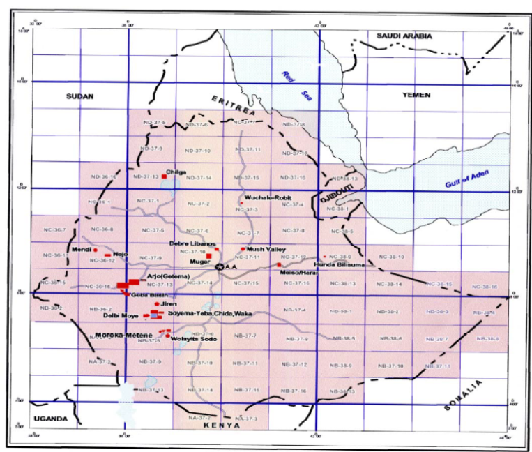
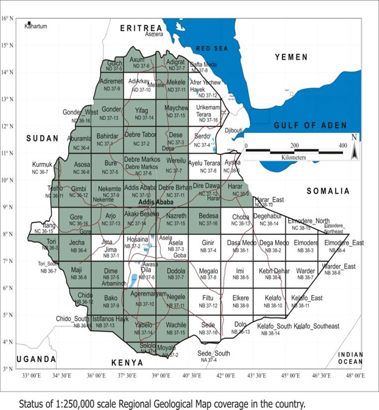
map coverage at 1:250,000 scale = 68%
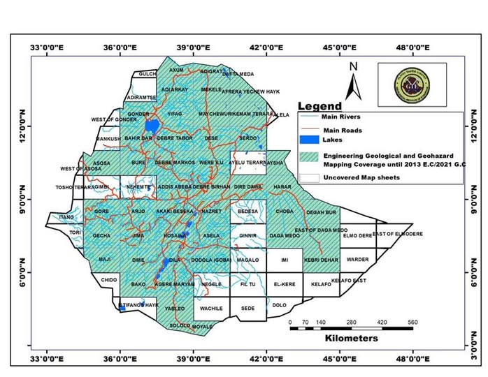
Engineering geological and geo-hazards distribution coverage map of Ethiopia at 1:250,000
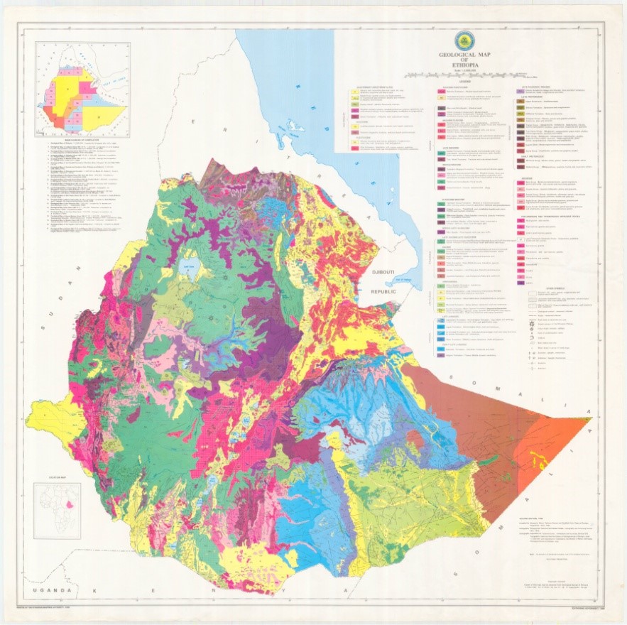
Second edition (Mengesha et al., 1996)
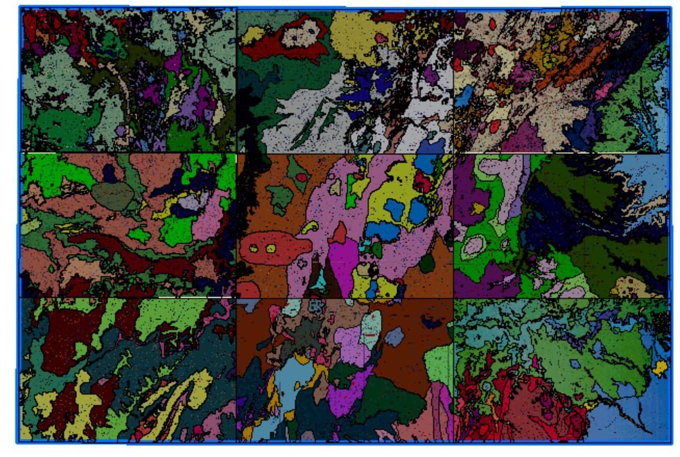
1:2,000,000 scale geological map of the country
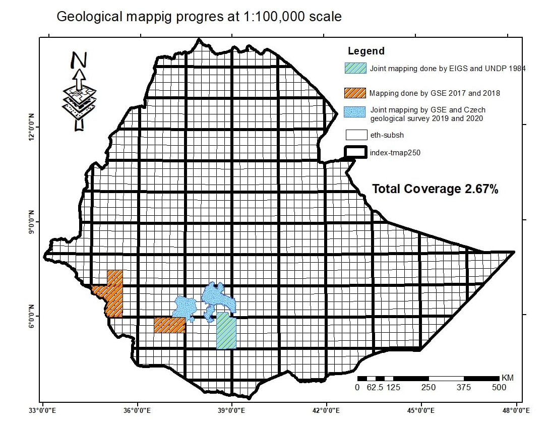
1:100,000 scale
Geological and Geochemical Mapping Coverage
1968-1997
20% of the country’s territory is covered by geochemical surveys conducted at various scales
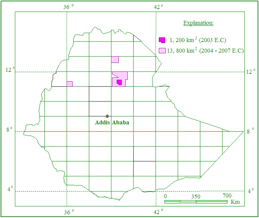
Northern Ethiopia Geochemical Mapping Project
1.2% (15000km2) coverage
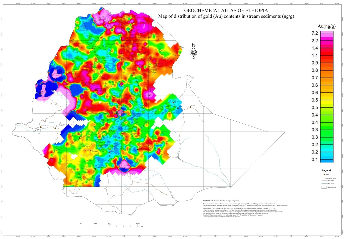
Geochemical Atlas of Ethiopia
Map of distribution of gold contents in stream sediments (ng/g)
geological and geochemical mapping coverage
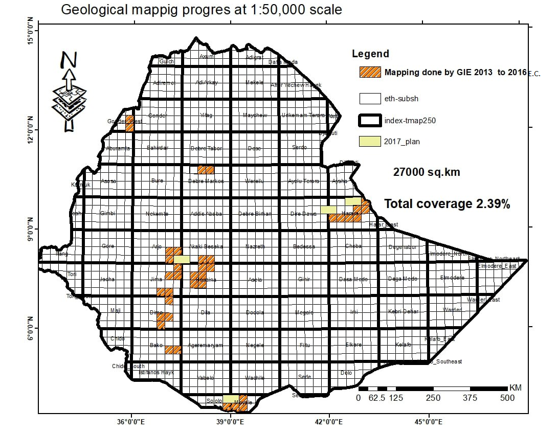
1:50,000 scale
Pre-field preparation
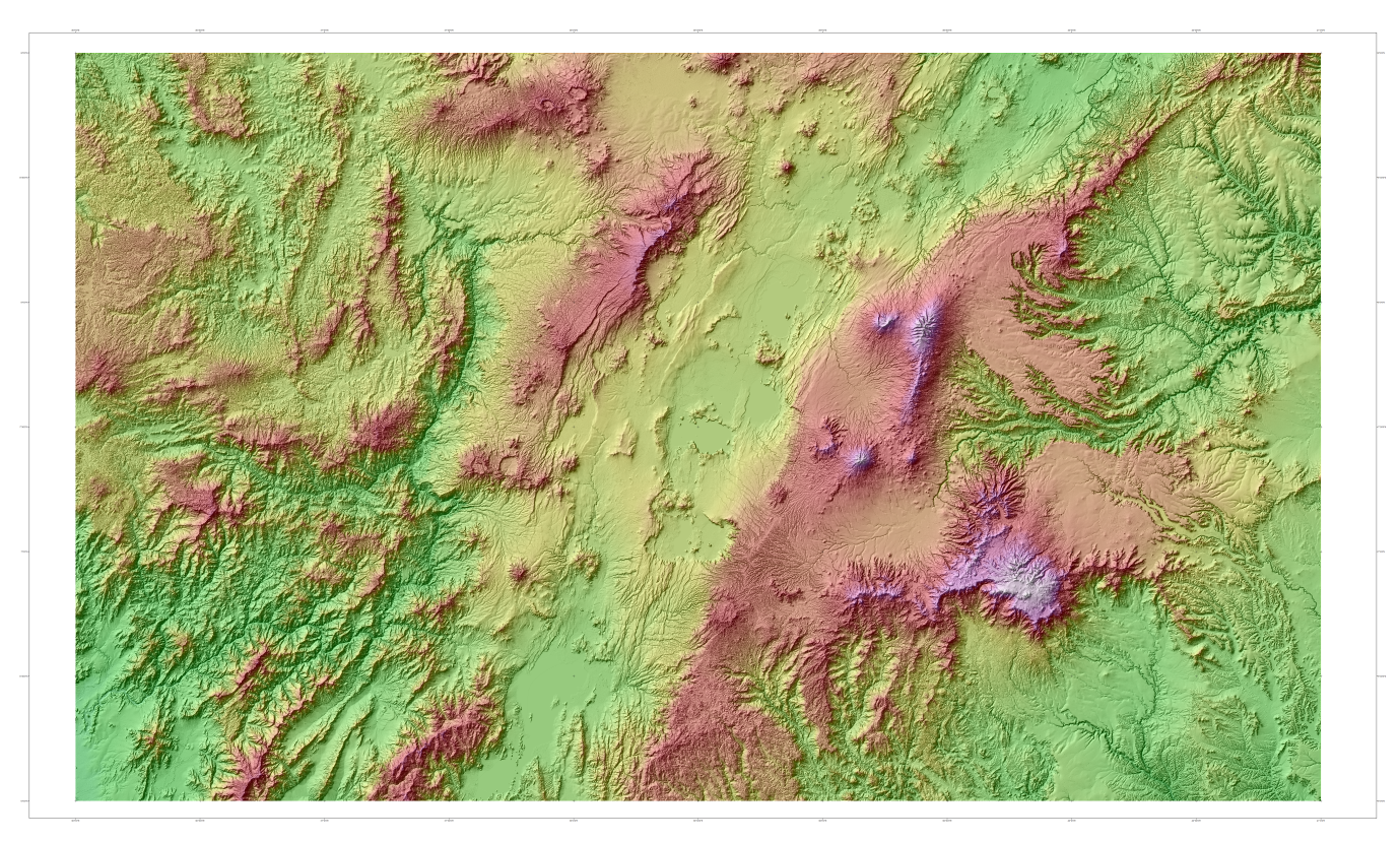
Preparatin of the Digital Elevation Model (DEM) of the study area
Satellite image
interpretation to produce the draft geological map of the study area
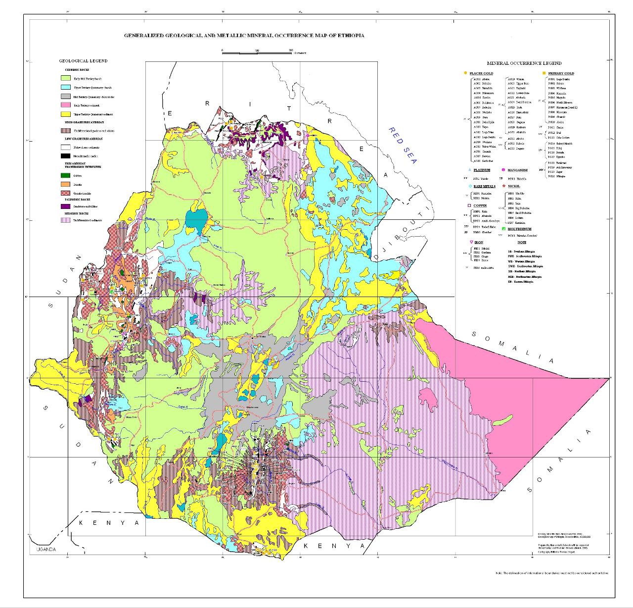
mineral occurence map
Geoscience
Geochemical mapping
Sample Collection
Post field work
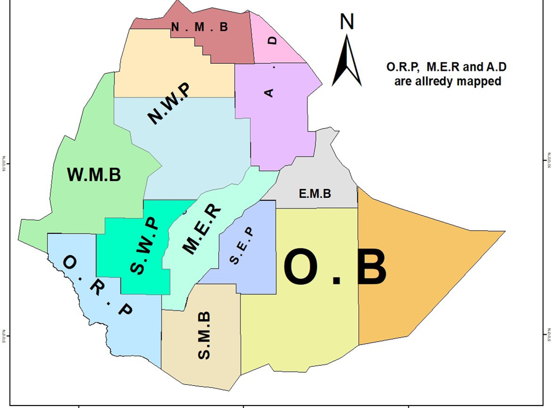
በ2018 ዓ.ም ሊሰሩ የታቀዱ የፕሮጀክት ቦታዎች - Eastern Metamorphic Belt (E.M.B)
1:250,000 Scale
Regional Geological Map Coverage in the country
fenetali
Volcano 2025 in Ethiopia Afar Regional State
 +251-116-463-357
  2302
2302