Geo-Hazard and Engineering Geology Research Executive activities are
Investigating the occurrence of natural hazards (earthquake hazard, slope instability hazard, flooding hazard, volcanic hazard and etc.)
Conducting integrated engineering geological, geological, hydrogeological and geophysical investigations to assess geohazards,
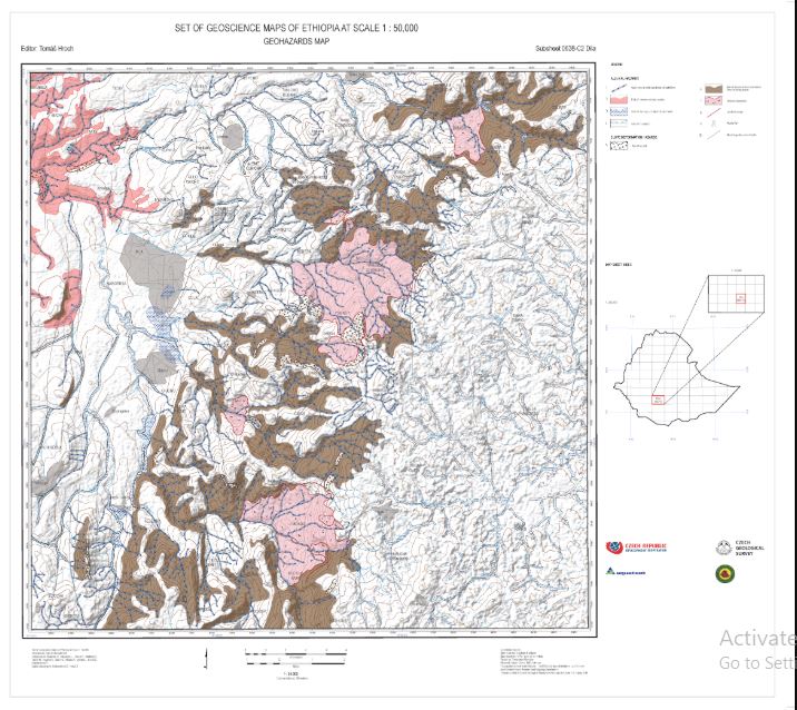
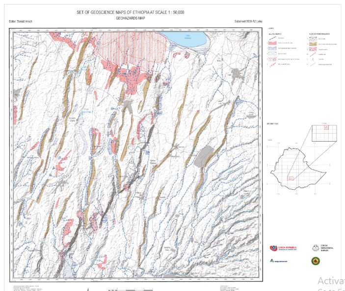
Producing geohazards zonation maps including explanatory reports,
Producing engineering geological maps including accompanying explanatory reports,
Selecting and assessing suitable sites for the construction of different structures (dams, buildings, bridges, roads, industry zones, smart cities and etc.)
Selecting suitable waste disposal sites for urban areas,
Selecting suitable construction materials and reserve estimation,
Conducting geotechnical investigation, for building foundations, dam sites, roads and tunnels
Providing consultancy service in the areas of engineering geology and geohazards etc. to government and non-governmental organizations;
Slope stability analysis, geohazards monitoring instrument installation, geohazards monitoring data analysis and working on alternative remedial measures.
 +251-116-463-357
  2302
2302